
Armona, California
Armona, California | |
|---|---|
 Armona, California | |
 Location in Kings County and the state of California | |
 Armona, California Location in the United States | |
| Coordinates: 36°18′57″N 119°42′30″W / 36.31583°N 119.70833°W | |
| Country | |
| State | |
| County | |
| Area | |
• Total | 2.05 sq mi (5.32 km2) |
| • Land | 2.05 sq mi (5.32 km2) |
| • Water | 0.00 sq mi (0.00 km2) 0% |
| Elevation | 239 ft (73 m) |
| Population (2020) | |
• Total | 4,274 |
| • Density | 2,081.83/sq mi (803.81/km2) |
| Time zone | UTC−8 (Pacific (PST)) |
| • Summer (DST) | UTC−7 (PDT) |
| ZIP code | 93202 |
| Area code | 559 |
| FIPS code | 06-02700 |
| GNIS feature IDs | 1652665, 2407762 |
Armona is a census-designated place (CDP) in Kings County, California, United States. Armona is located 3.5 miles (5.6 km) west-southwest of Hanford,[3] at an elevation of 239 feet (73 m).[2] It is part of the Hanford–Corcoran Metropolitan Statistical Area. The population was 4,156 at the 2010 census.[4] Armona's motto is "Small and Proud".
Geography
[edit]Armona is located in northern Kings County at 36°18′57″N 119°42′30″W / 36.31583°N 119.70833°W.[2] California State Route 198 runs through the community, leading east into Hanford, the county seat, and west 4 miles (6 km) to Lemoore.
According to the United States Census Bureau, the CDP has a total area of 2.05 square miles (5.3 km2), all of it land.
History
[edit]The name "Armona" was applied to a railroad station in the 1880s. It was subsequently transferred to the present location on the Southern Pacific Railroad in 1891. Reportedly, the name was coined by transposing the first two letters of the name "Ramona".[5]
The first school in the Armona vicinity was the Giddings School built in 1880. The Giddings School District was renamed Armona in 1907. A new brick school house was constructed in the early 1920s. As that structure did not comply with California's earthquake standards (the Field Act), it was replaced in 1953 with what is now the Armona Elementary School.[6]
The Armona post office was established in 1887.[3]
Demographics
[edit]| Census | Pop. | Note | %± |
|---|---|---|---|
| 2000 | 3,239 | — | |
| 2010 | 4,156 | 28.3% | |
| 2020 | 4,274 | 2.8% | |
| U.S. Decennial Census[7] 1850–1870[8][9] 1880-1890[10] 1900[11] 1910[12] 1920[13] 1930[14] 1940[15] 1950[16] 1960[17] 1970[18] 1980[19] 1990[20] 2000[21] 2010[22] | |||
The 2020 United States census reported that Armona had a population of 4,274. The population density was 2,081.8 inhabitants per square mile (803.8/km2). The racial makeup of Armona was 30.2% White, 3.1% African American, 1.8% Native American, 2.2% Asian, 0.0% Pacific Islander, 40.9% from other races, and 21.8% from two or more races. Hispanic or Latino of any race were 74.3% of the population.
The whole population lived in households.
There were 1,241 households, out of which 45.2% included children under the age of 18, 51.7% were married-couple households, 6.9% were cohabiting couple households, 26.6% had a female householder with no partner present, and 14.7% had a male householder with no partner present. 16.4% of households were one person, and 6.7% were one person aged 65 or older. The average household size was 3.44. There were 983 families (79.2% of all households).
The age distribution was 30.3% under the age of 18, 10.3% aged 18 to 24, 26.6% aged 25 to 44, 22.1% aged 45 to 64, and 10.7% who were 65 years of age or older. The median age was 31.2 years. For every 100 females, there were 94.1 males.
There were 1,279 housing units at an average density of 623.0 units per square mile (240.5 units/km2), of which 1,241 (97.0%) were occupied. Of these, 61.2% were owner-occupied, and 38.8% were occupied by renters.[23][24]
Economy
[edit]In 2023, the US Census Bureau estimated that the median income for a household in the CDP was $60,100, and the median income for a family was $60,991. The per capita income for the CDP was $19,293. About 12.2% of families and 11.7% of the population were below the poverty line, including 15.2% of those under age 18 and 4.3% of those age 65 or over. It was estimated that 10.5% of people were unemployed.[25]
Transportation
[edit]Bus
[edit]Kings Area Regional Transit (KART) operates regularly scheduled fixed route bus service, vanpool service for commuters and Dial-A-Ride (demand response) services throughout Kings County as well as to Fresno [1].
Major highway
[edit]Rail
[edit]Amtrak does not have a station in Armona but does provide passenger service to Hanford, which is 3.5 miles (5.6 km) east of Armona. Freight service is available from the San Joaquin Valley Railroad, which passes through Armona.
Education
[edit]Public schools in the community are operated by the Armona Union Elementary School District. They include:
- Armona Elementary School
- Parkview Middle School
The district also sponsors the Crossroads Charter Academy, a K-12 independent study charter school.
There is one K-12 private school, Armona Union Academy, which is operated by the Seventh-day Adventist Church.
Armona is in the Hanford Joint Union High School District.
Nearby community colleges include West Hills College Lemoore and the Hanford center of College of the Sequoias.
Government
[edit]In the California State Legislature, Armona is in the 14th Senate District, represented by Democrat Anna Caballero, and in the 32nd Assembly District, represented by Republican Stan Ellis.[26]
In the United States House of Representatives, Armona is in California's 21st District and is represented by Democrat TJ Cox. Armona is represented on the Kings County Board of Supervisors by Craig Pedersen.[27]
Notable people
[edit]Lyn Lary played shortstop for six different teams in his twelve-year career in Major League Baseball including with the New York Yankees
Notable sites
[edit]
The United Methodist Church was constructed in 1910.
References
[edit]- ^ "2020 U.S. Gazetteer Files". United States Census Bureau. Retrieved October 30, 2021.
- ^ a b c "Armona". Geographic Names Information System. United States Geological Survey, United States Department of the Interior. Retrieved November 2, 2014.
- ^ a b Durham, David L. (1998). California's Geographic Names: A Gazetteer of Historic and Modern Names of the State. Clovis, California: Word Dancer Press. p. 994. ISBN 1-884995-14-4.
- ^ "Geographic Identifiers: 2010 Demographic Profile Data (G001): Armona CDP, California". U.S. Census Bureau, American Factfinder. Retrieved January 25, 2019.[dead link]
- ^ Durham, David L. (2001). Place-Names of Central California. Clovis, California: Word Dancer Press. p. 6. ISBN 1-884995-33-0.
- ^ Gibson, Harold (2001). History of Kings County Public Schools. Hanford, California: George Watson, Copy Connection.
- ^ "Decennial Census by Decade". United States Census Bureau.
- ^ "1870 Census of Population - Population of Civil Divisions less than Counties - California - Almeda County to Sutter County" (PDF). United States Census Bureau.
- ^ "1870 Census of Population - Population of Civil Divisions less than Counties - California - Tehama County to Yuba County" (PDF). United States Census Bureau.
- ^ "1890 Census of Population - Population of California by Minor Civil Divisions" (PDF). United States Census Bureau.
- ^ "1900 Census of Population - Population of California by Counties and Minor Civil Divisions" (PDF). United States Census Bureau.
- ^ "1910 Census of Population - Supplement for California" (PDF). United States Census Bureau.
- ^ "1920 Census of Population - Number of Inhabitants - California" (PDF). United States Census Bureau.
- ^ "1930 Census of Population - Number and Distribution of Inhabitants - California" (PDF). United States Census Bureau.
- ^ "1940 Census of Population - Number of Inhabitants - California" (PDF). United States Census Bureau.
- ^ "1950 Census of Population - Number of Inhabitants - California" (PDF). United States Census Bureau.
- ^ "1960 Census of Population - General population Characteristics - California" (PDF). United States Census Bureau.
- ^ "1970 Census of Population - Number of Inhabitants - California" (PDF). United States Census Bureau.
- ^ "1980 Census of Population - Number of Inhabitants - California" (PDF). United States Census Bureau.
- ^ "1990 Census of Population - Population and Housing Unit Counts - California" (PDF). United States Census Bureau.
- ^ "2000 Census of Population - Population and Housing Unit Counts - California" (PDF). United States Census Bureau.
- ^ "2010 Census of Population - Population and Housing Unit Counts - California" (PDF). United States Census Bureau.
- ^ "Armona CDP, California; DP1: Profile of General Population and Housing Characteristics - 2020 Census of Population and Housing". US Census Bureau. Retrieved March 31, 2025.
- ^ "Armona CDP, California; P16: Household Type - 2020 Census of Population and Housing". US Census Bureau. Retrieved March 31, 2025.
- ^ "Armona CDP, California; DP03: Selected Economic Characteristics - 2023 ACS 5-Year Estimates Comparison Profiles". US Census Bureau. Retrieved March 31, 2025.
- ^ "Statewide Database". UC Regents. Archived from the original on February 1, 2015. Retrieved December 10, 2014.
- ^ "District Map: County of Kings Board of Supervisors". Kings County. Retrieved August 4, 2017.
External links
[edit]Municipalities and communities of Kings County, California, United States | ||
|---|---|---|
| Cities | 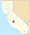 | |
| CDPs | ||
| Unincorporated communities | ||
| Ghost towns | ||